The Indo-Gangetic Plain, a vast and densely populated region spanning across India, Bangladesh, and parts of Nepal, faces a myriad of challenges, with floods emerging as a recurrent and devastating issue. The intricate network of rivers, including the Ganges, Brahmaputra, and their tributaries, creates a complex hydrological system prone to frequent inundations. Floods in the Indo-Gangetic Plain result from a combination of natural factors, such as heavy monsoon rains and glacial meltwater, compounded by anthropogenic influences like deforestation and urbanization. The consequences of these floods are far-reaching, impacting communities, agriculture, and infrastructure. Effective flood management in this region requires a holistic approach that integrates sustainable environmental practices, advanced technology, and community participation to mitigate the devastating effects of floods and build resilience in the face of this recurring challenge. This discussion aims to delve into the multifaceted problems associated with floods in the Indo-Gangetic Plain and explore viable strategies for their sustainable management.
Contents
Answer
More than 40 million hectare area in India is flood-prone and the northern plain region is the worst hit especially during monsoons and damage is caused to crops, houses, and public utilities.
PROBLEMS OF FLOODING IN INDO-GANGETIC / NORTHERN PLAINS
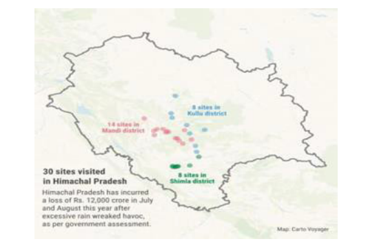
Disaster in Himachal Pradesh-

- within 15 days of monsoon onset, 41 landslides,29 flash floods, and 1 cloud burst in the region
- Boulders and large pieces of wood led to the jamming of the floodgates of the 100-MW Malana ii hydropower facility, located on the Malana, a tributary of the Beas River.
- Himachal Pradesh’s state of environment report – 2022:- mt areas highly vulnerable to disaster, development compounded problem which disturbed natural balance of physical processes.
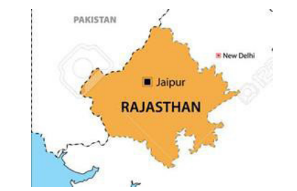
Unsustainable development – Jaipur City (UN- habitat)-


- According to the Jaipur Meteorological Centre, 132mm rainfall was recorded in the city, Officials attributed the heavy rains to a cyclonic circulation over east Rajasthan.after three hours of continuous rain. Water-filled government offices, hospitals, and buses. It washed away many shanties in low-lying areas. Jaipur got an overall sustainability rating of three on the Urban Sustainability Assessment Framework (USAF)Lack of green cover has resulted in the urban heat island effect that has disrupted biodiversity, and concretization causing floods.
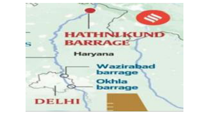
Encroachment of Yamuna floodplain

- The Yamuna River in Delhi flooded the nearby streets, public facilities, and private infrastructure because of intense rainfall within a relatively short period
- CWC said water released from the Hathnikund barrage took less time to reach Delhi .”Encroachment of the floodplains may have an incremental effect.
- According to the last Drainage Master Plan of Delhi in 1976, Delhi had 201 tributaries/storm water drains. However, around 19 of the 201 natural drains could not be traced as they were either encroached upon, blocked with waste, or disappearing.
Erratic monsoon – North India
- Climate change has impacted the monsoon, making it irregular with sudden, extreme rainfall events.
- Extreme rainfall in north India with 62% excess.
- Mid-latitude trough directs the flow of moisture towards the Himalayas .
- Deep convection triggered by orographic rainfall.
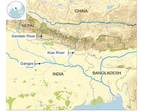
River Kosi avulsions

- 113 avulsions have been documented worldwide as per the satellite imagery from 1973-2020 and historical maps.
Over the last 250 years, the Kosi has shifted its course over 120 kilometers from East to West and the unstable nature of the river is attributed to the heavy silt it carries during the monsoon season and leads to frequent flooding.
Flood management in the Indo – Gangetic Plains
- Sustainable cities integrated approach – by UN-HABITAT based on the urban sustainability
assessment framework of Jaipur city, work on the lines of mitigating the problems of urban sprawl, redevelopment of compact settlement, rainwater harvesting using 800 dried up wells. This will increase the groundwater table, minimize urban floods, and promote effective water resource utilization, eco trails – green cover. - The present proposal is an extension of the Eastern Kosi Main Canal (EKMC) system up to River Mechi, a tributary of river Mahananda.To provide irrigation benefits to the water-scarce Mahananda basin command and to overcome the acute problem of shifting of course of Kosi river, heavy sediment load, flooding, etc., and to alleviate the severe suffering of the people of Bihar.
- Befikr app – Bihar, provides real-time information about floods and people can share related
problems with the government via this app. - Floodplain zoning – guidelines on floodplain zoning by the National Disaster Management Authority, defense installations, industries, and public utilities like hospitals, electricity installations, water supply, telephone exchanges, aerodromes, railway stations, commercial centers, etc. should be located such that they are above the levels corresponding to a 100-year frequency or the maximum observed flood levels.
The Indo – Gangetic plain has always been flood-prone, causing harm to lives. A Kerala-based radio wireless system can be used in this region to rescue people during floods. It’s useful during power outages, no mobile network, satellite snags, and remoteness.
In case you still have your doubts, contact us on 9811333901.
For UPSC Prelims Resources, Click here
For Daily Updates and Study Material:
Join our Telegram Channel – Edukemy for IAS
- 1. Learn through Videos – here
- 2. Be Exam Ready by Practicing Daily MCQs – here
- 3. Daily Newsletter – Get all your Current Affairs Covered – here
- 4. Mains Answer Writing Practice – here

