
02 Apr
UN World Water Development Report 2022
In News
The 2022 edition of the United Nations World Water Development Report (UN WWDR 2022) entitled ‘Groundwater: Making the invisible visible’ describes the challenges and opportunities associated with the development, management, and governance of groundwater across the world.
Introduction
- Groundwater – accounting for approximately 99% of all liquid freshwater on Earth and distributed over the entire globe, albeit unequally – has the potential to provide societies with tremendous social, economic, and environmental benefits, including climate change adaptation.
- Groundwater already provides half of the volume of water withdrawn for domestic use by the global population, and around 25% of all water withdrawn for irrigation, serving 38% of the world’s irrigated land.
- Yet, despite its enormous importance, this natural resource is often poorly understood, and consequently undervalued, mismanaged and even abused. In the context of growing water scarcity in many parts of the world, the vast potential of groundwater and the need to manage it carefully can no longer be overlooked.
State of groundwater resources


Freshwater withdrawal, water stress and water scarcity
- Freshwater withdrawal from streams, lakes, aquifers, and human-made reservoirs (so-called ‘blue water’ sources) has increased strongly during the last century, and is still increasing in most parts of the world. Global freshwater withdrawal was probably around 600 km³/year in 1900 and increased to 3,880 km³/year in 2017.
- An estimated four billion people live in areas that suffer from severe physical water scarcity for at least one month per year.
- Blue water footprint refers to ‘blue water consumption’ or ‘net water withdrawal’ and is equal to the volume of ‘blue water’ (= fresh surface water and groundwater combined) that is withdrawn and not returned to groundwater or surface water systems because the water evaporated or was incorporated into a product.
- Blue water availability over a given area is calculated as the sum of runoff generated in that area and received from upstream, minus the environmental flow requirements of all contributing areas, and minus the water footprint in all upstream contributing areas.


The multiple services offered by groundwater

Challenges related to groundwater
- Long-term groundwater storage depletion: The rate of global aggregated groundwater storage depletion is considerable at estimated rates of between 100 and 200 km³/year. Land use, land use practices, artificial drainage and surface water management are key human activities influencing groundwater storage.
- Groundwater pollution: Groundwater pollution reduces the suitability of abstracted groundwater for drinking purposes and other human uses, while it may also affect groundwater-dependent ecosystems. There are many sources of anthropogenic groundwater pollution:
- At or near the land surface - agriculture, households, sewerage, landfills, industries and other urban sources, storage tanks, roads, canals, pipelines, etc.
- Below the surface - wells, oil and gas development, mining, subsurface disposal.
- Groundwater salination: One of the mechanisms is related to flooding by seawater. Seawater inundating low-lying coastal land tends to infiltrate into underlying aquifers, replacing fresh groundwater by saline water. This happens either suddenly, during exceptional events (storm surges or tsunamis), or gradually, in tandem with the slow marine transgression caused by sea level rise.
- Priority, allocation, and access issues in absence of any form of community or government control, it is unlikely that an optimal combination of groundwater services will develop in a given area, and that all inhabitants will share equally in the benefits from groundwater.
Global interconnections of Ground Water
- Groundwater in the global water cycle, interacting with climate and other global systems: With its specific characteristics, especially its buffering capacity, groundwater puts its distinct mark on the global water cycle. However, the global water cycle and its water budget are not in a dynamic equilibrium: they are being modified by climate change and by increasingly significant human interferences, such as groundwater withdrawal and land use practices.
- Groundwater and Earth system resilience: Different processes within the global water cycle regulate climate and support ecosystems. Human activities – including groundwater withdrawal – currently are a major force disturbing these processes, potentially causing planetary-scale regime shifts threatening the stability of our planet.
- Groundwater and sea level rise: Intensive groundwater withdrawal causes a reduction of stored terrestrial water, which produces a nearly equal increase of the volume of water in the oceans. The main impacts of sea level rise are coastal inundation, flooding and increasing saline water intrusion.
- Global degradation of groundwater-dependent ecosystems: Continuously expanding groundwater withdrawal across the globe causes global-scale decline of baseflows, springs, artesian flows and wetlands, leading to loss of the biodiversity and to encroaching desertification in the longer run.
- Groundwater and global trade: 22% of water use in the world is for producing export products. Consequently, large volumes of ‘virtual water’ travel across the world. For 2010, global groundwater depletion embedded in food production was estimated at 141 km³/year, of which 26 km³/year was exported.
Regional perspectives on Ground Water

Ground Water Sectoral Use Analysis
- Groundwater use in the agricultural sector: Regions heavily reliant on groundwater for irrigation include North America and South Asia, where 59% and 57% of the areas equipped for irrigation use groundwater, respectively.
- Agricultural pollution of water has overtaken contamination from settlements and industries. Nitrate, from chemical and organic fertilizers, is the most prevalent anthropogenic contaminant in groundwater globally.
- Human settlements and Ground Water: Nearly 50% of the global urban population today is estimated to be supplied from groundwater sources. However, many urban poor live in peri-urban settlements, which are unplanned and lack legal status, and where public water infrastructure and services are not provided. In developing economies, the use of private water wells for urban self-supply has proliferated in recent years.


- Groundwater abstraction and use in industry: Industry and energy account for 19% of global freshwater withdrawals. This number refers to self-supplied water (which includes groundwater). The data also point to big geographic differences, with industrial withdrawal varying from 5% in Africa to 57% in Europe.

- Ecosystem and Ground Water: Groundwater-dependent ecosystems (GDEs) consist of plants, animals and fungi that rely on the flow, temperature, or chemical characteristics of groundwater for all or some of their water needs. GDEs are extremely diverse and can be divided into three classes based on the expression of groundwater within the ecosystem. These include:
- aquatic GDEs, which depend on the interaction of groundwater and surface water, such as springs, wetlands, and estuaries, as well as groundwater discharge and baseflow in rivers, streams, wetlands, and coastal zones.
- terrestrial GDEs, which depend on ecologically accessible groundwater; and
- subterranean GDEs, which depend on aquifers and karst systems, including the hyporheic zones of rivers and floodplains.
The shared well-being of groundwater, ecosystems and humans may be enhanced by groundwater management, conjunctive water and land management, nature-based solutions, and improved ecosystem protection.
- Climate change impacts on groundwater resources: Climate change directly impacts the natural recharge of groundwater through its influence on precipitation and on leakage from surface waters, including ephemeral streams, wetlands, and lakes.
- Changes in ice and snow Across continental northern latitudes, as well as in mountainous and polar regions, global warming alters meltwater flow regimes from ice and snow, impacting groundwater recharge.
- In temperate regions, warming results in less snow accumulation and earlier snowmelt, as well as more winter precipitation falling as rain and an increased frequency of rain-on-snow events.
- Sea level rise and salinization of coastal aquifers: Coastal aquifers form the interface between oceanic and terrestrial hydrological systems and provide a critical source of freshwater for people in coastal regions. Global SLR of ~3 mm/year since 1990, relative to ~1 mm/year from 1902 to 1990, has induced seawater intrusion into coastal aquifers around the world.
Sustainable solution to ground water problem
- Tapping the unexploited groundwater potential: In contrast to intensively exploited aquifers, in several regions of the world there are also aquifers that are still exploited at very low rates, far below the maximum sustainable rates. These aquifers harbour an unexploited groundwater potential, available for being tapped and used. Many of them can be found in sparsely populated regions of Sub-Saharan Africa and the northern half of South America.
- Expanding anthropogenic replenishment of the groundwater buffer: Managed aquifer recharge (MAR) is an effective technical intervention that makes use of the naturally available storage capacity of the subsurface. Excess water that otherwise would be lost is temporarily stored and made available for beneficial use at a later moment in time.
- Managing Transboundary aquifers: Transboundary aquifer management often suffers from a lack of institutional will and insufficient resources to collect the necessary information, especially at the local level. Coordinating, harmonizing, and sharing data represents the first step in cooperation between neighbouring countries. The integration of gender considerations into transboundary cooperation generates opportunities for more socially equitable groundwater management.
- Financing: Government budgets should, at minimum, fund groundwater monitoring – quality and quantity, and related operating and maintenance costs – and leverage private investment by funding initial exploratory and management initiatives.
Where to use
Geography P1 and P2
GS P1, P3
Source:
Conservation of Endangered Languages
Why in news:
A comprehensive study led by the Australian National University (ANU), warns that 1,500 endangered languages all over the world, could no longer be spoken by the end of this century.
Background:
- About 97% of the world’s people speak about 4% of the world’s languages; and conversely, about 96% of the world’s languages are spoken by about 3% of the world’s people. Most of the world’s language heterogeneity, then, is under the stewardship of a very small number of people.
- A language is endangered when it is on a path toward extinctione., when its speakers cease to use it, use it in an increasingly reduced number of communicative domains, and cease to pass it on from one generation to the next.
- There are 7,000 living languages in the world and around 3,000 are considered as ‘endangered’. This means that almost half of the planet’s current linguistic diversity is under threat.
- The situation in India is alarming. Some 197 languages are in various stages of endangerment in our country, more than any other country in the world. India may have lost 220 languages since 1961. There were 1,100 languages since 1961, based on the Census number of 1,652 mother tongues. Another 150 languages could vanish in the next 50 years.
- The Mahali language in eastern India, Koro in Arunachal Pradesh, Sidi in Gujarat and Dimasa in Assam are facing extinction. UNESCO has put Asur, Birhor and Korwa in its list of the world’s endangered languages with Birhor being categorized as ‘Critically Endangered’.

Language endangerment around the world:

Key Discussions on Language Endangerment
- Language diffusion and endangerment: Diffusion of language happens through several ways such as migration, government policy and language shift etc.
- Migration: The spread of language happens with the migration of people. For example, during colonial times, many Indian labors migrated to Maldives, Fiji and as of now Hindi is widely spoken language in these countries.
- When speakers of Proto-Indo-European migrated to most of Europe and large parts of Asia between 6,000 and 8,000 years ago, they probably brought about massive language change and language death. In Western Europe, Basque could possibly be the only modern language that survived the influx of the Indo-Europeans.
- Government policy: Promotion of a particular language through government support will enhance the diffusion process of language. E.g., The spread of Arabic Persian language during the Mughal era.
- Language shift: Convergence of many languages in one place resulting in the dominance of majoritarian language and extinction of minority languages is called as language shift.
- Migration: The spread of language happens with the migration of people. For example, during colonial times, many Indian labors migrated to Maldives, Fiji and as of now Hindi is widely spoken language in these countries.
- Climate change and language endangerment: In the coming centuries, we may experience an increase in climate-related migration. It is already clear that climate change influences modern migration patterns.
- Also, the areas affected by climate-related disasters are often ones that exhibit great linguistic diversity and include languages with small numbers of speakers, which are especially vulnerable.

What happens when a language dies?
When a language dies, its speakers decide to migrate. First, they migrate to another language and then they physically start migrating to another region. The second thing that happens is that their traditional livelihood patterns go down. They may have some special skills and that disappears. Thirdly, a unique way of looking at the world disappears. Every language is a unique worldview.
Strategies for the conservation of endangered languages:
- Revitalization through immersion: Communities around the world have increasingly looked to schools and other teaching programs to revitalize their languages. E.g., in Hawaiian immersion schools Hawaiian is used across the curriculum from pre-school onwards, and English is introduced as a subject from the fifth grade.

- Supporting and developing national language policy: National language policies must support diversity, including endangered languages. More social scientists and humanists, and speakers of endangered languages themselves should be actively involved in the formulation of national language policies.

- UNESCO Atlas of the World's Languages in Danger: It is intended to raise awareness about language endangerment and the need to safeguard the world’s linguistic diversity among policymakers, speaker communities and the general public.
- The International Year of Indigenous Languages: It is a United Nations observance in 2019. It aims to raise awareness of the consequences of the endangerment of indigenous languages across the world, with an aim to establish a link between language, development, peace, and reconciliation.

Where it can be used?
It can be used in topics related to Paper 1 (Climate change, consequences of migration) and Paper 2 (Linguistic diversity, migration, and globalization) and GS1 (Globalization and Diversity of India).
Sources:
- 1,500 endangered languages could disappear by the end of the century:
- Could climate change cause languages to die?:
- Language Vitality and Endangerment:
- Preserving Endangered Languages:
- Experts discuss conservation of endangered languages:
- Seven decades after independence, many tribal languages in India face extinction threat:
- ‘There are 600 potentially endangered languages in India… each dead language takes away a culture system’:
Disclimax
- It is the short form of “Disturbed Climax” A stable plant community resulting from the disturbance of CLIMAX VEGETATION.
- It occurs due to repeated but unpredictable disturbances that prevent the vegetation to reach the climax stage of ecological succession.
- the former climax has been largely replaced by new species which might not be expected for that area.
- In recent times the human activities such as agriculture, Urbanisation, Industrialisation, and introduction of new alien species are replacing the natural climax communities with something else.
- g. the prickly pear cactus (Native to Americas), has formed a DISCLIMAX over wide areas in Australia.

Source:
Goletz terraces
- Goletz terraces (also known as altiplanation or Cryoplanation terraces) are periglacial landforms.
- It is consisting of nearly horizontal bedrock surfaces or benches backed by frost-weathered bedrock cliffs.
- It is like a summit bench that is cut in bedrock and transects lithology and structure.
- These are erosional landforms reminiscent of Giant staircases (Glacial staircase), with alternating shallow sloping treads and steep scarps leading to extensive flat summits.
- These are found only in the periglacial regione. Arctic regions of Alaska, Canada, Greenland, and Siberia and also in Antarctica, and the fossil zones of Pleistocene, and other past Ice Ages.
- Many different hypotheses for the formation of Goletz terraces have been proposed, such as
- Modification to the Davisian cycle erosion by Moffit 1905; Prindle 1905; Peltier 1950,
- A special phase of solifluction by Eakin, 1916,
- Complex sorting from mass-movement by Taber 1943.

Sources:
Ocean Acidification
- It is the phenomena of reduction in the pH level of the ocean water. This mainly occurs due to dissolution of CO2 in water to form Carbonic acid.
- The present pH level is 8.1e. basic/alkaline, it was 8.2 in pre industrial time. (pH is measured on the scale of 0 to 14 less than 7 indicates acidic nature greater than 7 is basic and 7 is neutral).
- The ocean absorbs 30% of all CO2 released in the atmosphere and 90% of anthropogenic release. Thus, pH of ocean water is expected to reach to 7.8 by 2100.
- Present rate of ocean acidification is 10 times faster than anything experienced during the last 300 million years, jeopardising the ability of ocean systems to adapt to changes in ocean chemistry due to CO2.
- Impact –
- Reduction of Calcite Compensation Depth (CCD) below which there is no calcareous deposit. CO2 concentration increases with the depth. Presently CCD is ~4000m.
- All calcite life forms such as Globigerina, pteropods, corals, etc. will get dissolved.

Source:
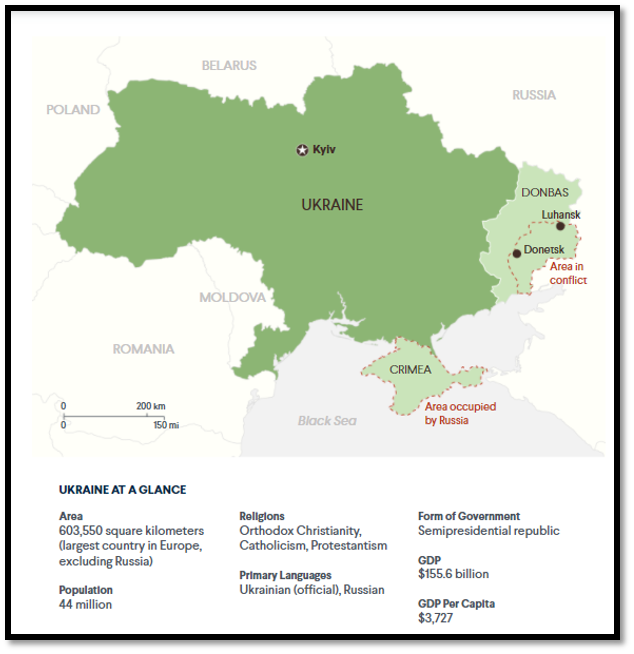
How prolonged conflicts left Libya vulnerable to climate change
Background
The impact of years of conflict has left Libya extremely vulnerable to climate variability and strained agricultural production. The country’s capacity to adapt has become weaker because necessary resources to mitigate climate risks are being shifted to deal with short- and long-term consequences of the protracted conflict.
Ground challenges
- Libya’s agriculture relies heavily on irrigation but limited renewable water resources, coupled with harsh climatic conditions and poor soil, severely limit production. Low agricultural yields force the country to import about 75 per cent of the food required to meet local needs.
- Libya is one of the driest countries in the world. Less than 2 per cent of the country receives enough rain to support agriculture and only 5 per cent of the country receives more than 100 millimetres of rainfall per year, Only 3.8 million hectares — 1-2 per cent of the country’s area can support crop growth.
- Around 95 per cent of the country, just south of the Mediterranean, is desert. The Mediterranean climate also renders many parts prone to floods, sandstorms, dust storms and further desertification.
- Conflict has left the country vulnerable to climate variability because of low adaptive capacity which is likely to increase the impacts of natural hazards on agricultural production.

Major dynamics threatening long-term peace and stability in Libya
- Libya’s reliance on global fossil fuels prices and its vulnerability to peak oil demand.(Libya has Africa’s largest oil and gas reserves)
- Ill-management of water policy which requires proper integration. Owing to the impacts of climate change, Libya is highly water-stressed. Scarcity of freshwater resources is driving inter-communal competition.
- Lack of water resources further threatens agricultural output as production has already declined 70% since 2011.
- Present conditions in Libya witness deficiencies in basic infrastructure, shortcomings in electricity and water systems. Rising temperatures are further complicating efforts to stabilize the electrical system at a point when demand is increasing but supply is short.
Steps take for bring relief in the region
- The government of Libya found larger sources of water in the deep southern fossil aquifers. To exploit this resource, a colossal pumping system called the Man-Made River (MMR) was built to lift freshwater located 500 meters below ground and transport it hundreds of kilometers to the population at the coast.
- With this seemingly limitless resource, the state created massive circular state farms in the desert
Conclusion: Repeated attacks on the Man-Made River, which provides 60 per cent of all freshwater used in Libya, threatens the water security of the entire country. The Libyan government must focus on less water-intensive crops and more on water-efficient technologies.
Sources:
Sariska Tiger Reserve
|
Sariska Tiger Reserve
|
|
Moradabad
|
|
Gahirmatha Marine Sanctuary
|
|
Mullaperiyar Dam
|
|
Theni
|
|
Goalpara
|

Share the article
Get Latest Updates on Offers, Event dates, and free Mentorship sessions.

Get in touch with our Expert Academic Counsellors 👋
FAQs
Geography Current Affairs focuses on the contemporary issues, events, and developments in the field of geography. It covers recent geographical phenomena, environmental changes, geopolitical shifts, and related news. This differs from regular geography studies which may focus more on foundational concepts, historical contexts, and theoretical frameworks.
Updates are provided regularly to ensure that subscribers stay informed about the latest developments in geography. Typically, updates are provided on a fortnightly basis, depending on the frequency of significant events and changes in the field.
Absolutely. Geography Current Affairs serves as a valuable resource not only for Geography optional but also for GS papers, especially GS Paper 1 (covering Indian Heritage and Culture, History, and Geography of the World and Society) and GS Paper 3 (covering Technology, Economic Development, Biodiversity, Environment, Security, and Disaster Management). It aids in building a holistic understanding of various topics and strengthens answer-writing skills by incorporating contemporary examples and perspectives.
Geography Current Affairs holds immense importance for UPSC preparation, particularly for aspirants opting for Geography optional. It helps candidates stay updated with the latest developments, geographical phenomena, environmental issues, and geopolitical shifts worldwide, aligning them with the dynamic nature of the subject as tested in the UPSC examinations.
