
24 Jun to 10 Jul, 2024
WATER SCARCITY TO SUSTAINABILITY
Why in news : The recurring urban water crises is compelling to rethink sustainable use of fast-depleting aquifers.
About :
The UN has highlighted that 4.8–5.7 billion people could suffer water shortages by 2050. There are a range of issues that affect water availability in India on a macro level. Some of them are interdependent and could be attributed to the following :
- Climate Change: In regions like the Middle East and North Africa (MENA), climate change has intensified droughts, reducing water availability for agriculture and domestic use.
- Population Growth: In urban centers like São Paulo, Brazil, rapid population growth has strained local water supplies, resulting in shortages during drought periods.
- Poor Water Management: The Yamuna River in India faces severe pollution from industrial and domestic waste, limiting its usability and contributing to water scarcity in Delhi and surrounding areas.
- Over-Extraction of Groundwater: In parts of Mexico City, excessive groundwater pumping has caused land subsidence and compromised the city's water supply.
- Environmental Degradation: Deforestation in the Amazon rainforest disrupts the regional water cycle, affecting rainfall patterns and river flow downstream.
- Political and Economic Factors : The Tigris-Euphrates basin, shared by Iraq, Syria, and Turkey, faces geopolitical tensions over dam construction and water diversion projects.

Consequences of Water Crisis
- Economic Impact : In California, USA, during severe droughts, agricultural losses amounted to billions of dollars annually due to reduced crop yields and increased production costs.
- Health Risks: Lack of clean water sources contributes to outbreaks of diseases like cholera in regions of sub-Saharan Africa and South Asia.
- Environmental Degradation: The drying of the Aral Sea in Central Asia due to water diversion for irrigation has devastated local ecosystems and fisheries.
- Social Disruption: In the Middle East, disputes over the Jordan River and other shared water bodies have contributed to regional tensions and conflicts.
- Migration and Displacement: In rural areas of India, water stress has driven migration to urban centers, putting pressure on already strained urban infrastructure.
- Food Insecurity: In parts of sub-Saharan Africa, periodic droughts have led to food crises, affecting millions of people dependent on rain-fed agriculture.


Measures to Overcome Water Scarcity
- Circular Water Economy: Maximize water use efficiency and reduce reliance on external sources.Eg Singapore's NEWater project.
- Water-Saving Techniques: Implement efficient agricultural methods like drip irrigation.
Eg:Israel's widespread use of drip irrigation. - Public Awareness Campaigns: Educate people on water conservation and sanitation practices. Eg India's Jal Shakti Abhiyan.
- Infrastructure Improvements: Upgrade water treatment plants and distribution networks.Eg Mumbai's water pipeline overhaul.
- Sustainable Water Management: Integrate water resource management considering all stakeholders. Eg Australia's Murray-Darling Basin Plan.
- Public-Private Partnerships: Collaborate between government, businesses, and NGOs for accelerated progress. Eg Coca-Cola and USAID's water replenishment initiatives.
- Community Participation: Empower local communities to manage water resources effectively. Eg.Rajasthan's Pani Panchayat system.
- Technological Solutions: Explore desalination, wastewater treatment, and rainwater harvesting.Eg California's Carlsbad Desalination Plant.
Government Initiatives
- National Water Mission (NWM): The primary goal is to conserve water, minimize wastage, and ensure more equitable distribution across and within states through integrated water resources development and management.
- Jal Jeevan Mission (JJM): Launched in 2019, aims to provide functional tap connections to every rural household in India by 2024, addressing SDG target 6.1 for universal and equitable access to safe and affordable drinking water by 2030.
- Ministry of Jal Shakti: Established in May 2019, this ministry consolidates various functions related to water management under a single entity to enhance coordination and efficiency.
- Atal Bhujal Yojana (ABY): Focuses on improving groundwater management in areas accounting for approximately 37 percent of the country's critical groundwater blocks.
- Pradhan Mantri Krishi Sinchayee Yojana (PMKSY): A centrally sponsored scheme launched in 2015 with a 75:25 center-state funding ratio (90:10 for the northeastern region and hilly states). Key objectives include:
- Accelerated Irrigation Benefit Programme (AIBP): Provides Central Loan Assistance (CLA) to major and medium irrigation projects nearing completion to save water and improve efficiency.
- National Aquifer Mapping and Management Programme (NAQUIM): Maps groundwater aquifers and creates management plans, covering 80 percent of the country.
- Bureau of Water Use Efficiency (BWUE): Acts as a facilitator to promote water use efficiency across various sectors, including irrigation, drinking water supply, power generation, and industry.
Way Forward to Overcome Water Scarcity
- Promotion of Water Conservation: Encourage rainwater harvesting and revive traditional practices like Kudimaramath in Tamil Nadu, Ahar Pynes in Bihar, and Bamboo Drip Irrigation in the Northeast.
- Demand-Side Management: Adopt a participatory approach with local community involvement, such as the Swajal model in Uttarakhand focusing on community-based water management, and the revival of Johads in Rajasthan by Rajendra Singh, known as the Waterman of India.
- Nature-Based Solutions: Utilize solutions that mimic natural processes for human, ecological, and societal benefits, like artificial floodplains to increase water retention and forest management to reduce sediment loadings. Eg Floodplain restoration projects in the Netherlands.
- River Basin Management: Manage river basins using a hydrological approach rather than administrative boundaries, and promote interlinking of rivers while addressing environmental concerns. Eg Integrated Ganga River Basin Management Plan.
- Evidence-Based Policy-Making: Develop robust water data systems with real-time monitoring capabilities, like Andhra Pradesh’s online water dashboard for mapping hydrological resources to improve policymaking.
- Implementing the Mihir Shah Committee Report: Restructure water governance in India by:
- Establishing a National Water Commission by merging the Central Water Commission (CWC) and the Central Groundwater Board (CGWB) to manage surface and groundwater as a single entity.
- Focusing on the management and maintenance of dams rather than constructing new ones.
- Adopting a participatory approach to water management.
Source :
https://scienceexchange.caltech.edu/topics/sustainability/water-scarcity
Where to use :
Paper II ( Geography Optional ) : Resources
GREAT NICOBAR ISLAND DEVELOPMENT PROJECT
Why in news : The opposition party has demanded the immediate suspension of all clearances granted to NITI Aayog’s Great Nicobar Island (GNI) Project.
About :
- The project, initiated by NITI Aayog and executed by the Andaman and Nicobar Islands Integrated Development Corporation (ANIIDCO), includes the development of a transshipment port, an international airport, a township, and a power plant.
- Over half of the project's area is situated within the Tribal Reserve Area, which is presently utilized by the Shompen, a particularly vulnerable tribal group.

Significance of the project
- Economic significance: The proposed port would enable GNI to emerge as a major hub for cargo transshipment, given its strategic location equidistant from Colombo, Port Klang (Malaysia), and Singapore.
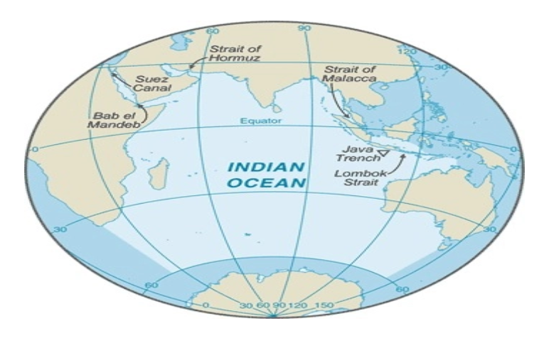
- Strategic significance: The development of GNI has been under consideration since the 1970s and has been consistently emphasized as vital for national security and the consolidation of the Indian Ocean Region. In recent years, the increasing Chinese presence in the Indian Ocean has intensified the urgency of this initiative.
Concerns Raised by Experts
- Denotification of ‘tribal reserve’: An Empowered Committee of the UT administration recommended denotifying the tribal reserve area, which experts claim violates the constitutional mandate.
- Flawed justification: Experts have criticized ANIIDCO's calculation of the area that will remain protected as a tribal reserve, describing it as “flawed.”
- Lack of consultation: The decision-making process has allegedly ignored the views of the Shompen and Nicobarese communities.
- Legal lacunae: Experts contend that the project clearances are fraught with legal gaps.
Impact on Indigenous Communities
- The Shompen and Nicobarese communities depend on the forested and riparian areas of the proposed project site for their foraging and habitation needs.
- The denotification of the tribal reserve negatively impacts the interests of these two tribal groups.
- The Great Nicobarese have ancestral villages located on the southeastern and western coasts, which are also within the project area.
Source :
Where to use :
Paper II ( Geography Optional ) : Regional Planning
Paper III ( General Studies ): Environment and Conservation issues
WEST ANTARCTICA VULNERABILITY
Why in the news : Antarctica is divided into West Antarctica and East Antarctica by the Transantarctic Mountains, which stretch from Victoria Land to the Ross Sea.
About :
West Antarctic Rift System (WARS)
- The West Antarctic Rift System is one of the Earth's major active continental rifts and significantly influences ice flows in West Antarctica. In western Marie Byrd Land, active glaciers move through fault-bounded valleys, or grabens, within the WARS.

West Antarctic Ice Sheet (WAIS)
- The West Antarctic Ice Sheet (WAIS) is the portion of the continental ice sheet that covers West Antarctica. It is classified as a marine-based ice sheet, meaning its bed lies well below sea level, and its edges flow into floating ice shelves. West Antarctica hosts the world's largest marine ice sheet.
- The WAIS is bordered by the Ross Ice Shelf, the Ronne Ice Shelf, and outlet glaciers that drain into the Amundsen Sea. The total volume of the entire Antarctic ice sheet is estimated at 26.92 million km³, with the WAIS containing about 2.1 million km³ of ice above sea level and 1 million km³ (240,000 cu mi) of ice below it.
- Climate Change Impact: Recent studies indicate that warmer ocean water is being driven toward the WAIS, destabilizing it and accelerating the decline of its massive glaciers. Antarctica as a whole lost more than 3 trillion tons of ice between 1992 and 2017, with most of that loss from West Antarctica, where the rate of ice loss has tripled in the past 25 years.
- Consequences: Thwaites and Pine Island Glaciers are considered part of the "weak underbelly" of the WAIS, as they appear vulnerable to irreversible retreat and collapse even under minimal warming. If these glaciers collapse, it could lead to the eventual disintegration of the entire ice sheet. The Thwaites Ice Shelf, which braces and restrains the eastern portion of Thwaites Glacier, is expected to collapse within a decade from 2021.

Recent finding
- Permanent glaciation of the Antarctic ice sheet began around 34 million years ago, but West Antarctica did not become permanently glaciated until at least seven million years after East Antarctica.
- During the first glacial maximum, West Antarctica was ice-free, covered by dense broadleaf forests, and had a cool-temperate climate, which inhibited ice formation.
Source :
Where to use :
Paper II ( Geography Optional ) : Global Warming
Paper III ( General Studies ) : Environment and Climate change
Incineration
Incineration : Incineration is a waste treatment process that involves burning organic substances present in waste materials. This process converts waste into ash, flue gas, and heat. The ash, primarily composed of inorganic components, can appear as solid lumps or particulates carried by the flue gas. In certain instances, the heat produced during incineration can be harnessed to generate electricity. Incineration with energy recovery is a type of waste-to-energy (WTE) technology, alongside other methods like gasification, pyrolysis, and anaerobic digestion.
Lahar
Lahar : A lahar is a flow of volcanic mud created when water mixes with volcanic ash, often possessing the destructive force of an avalanche. This water can come from seasonal rainfall or overflow from a crater lake. Lahars can also form when heavy or prolonged rainfall occurs during or after a volcanic eruption. On steep slopes, rainwater can easily erode and carry fine-grained, loose volcanic sediment, forming a slurry, particularly if vegetation has not yet regrown on recent volcanic deposits.
Placental Mammals
Placental Mammals : A placental mammal is an animal that has a placenta. The placenta is a vascular organ formed during gestation of female mammals (except for monotremes and marsupials), built up of maternal and fetal tissues jointly, and which serves for the transport of nutrient substances from the mother to the fetus and to eliminate fetal waste products. Placental mammals carry their fetus in the uterus until they are born at an advanced stage. The young get their nourishment through a placenta before birth. The placenta delivers nutrients and oxygen to the fetus in the uterus.
Diatom
Diatom : Diatoms are photosynthesizing algae present in nearly all aquatic environments, including freshwater and marine habitats, as well as soils and virtually any moist area. They have cell walls made of silica, with each species exhibiting a unique pattern of tiny holes in the cell wall (frustule) that allow them to absorb nutrients and expel waste. As single-celled, photosynthetic organisms, diatoms produce their own food in a manner similar to plants.
Bio Bitumen
Bio Bitumen : Bio-bitumen is a bio-based binder obtained from renewable sources like vegetable oils, crop stubble, algae, lignin (a wood component), or animal manure. Developed as a local alternative to petroleum bitumen, bio-bitumen helps reduce environmental impact. It is utilized in the construction of roads and roofs, serving as a direct replacement, modifier, and rejuvenator. Using straw in bio-bitumen technology for road construction can also help reduce pollution.
RESTORATION OF SONGOR WETLAND IN GHANA
The Songor wetland covers an estimated area of 51,133.3 ha and is the only natural point where the Volta River enters the sea. The boundaries of the site include the West Bank of the Lower Volta River estuary and the Songor lagoon. It was designated a Ramsar wetland site of international importance number 14 in August 1992. In 2011, UNESCO approved the Songor Biosphere Reserve as part of the World Network of Biosphere Reserves. The wetland has been facing the problem of sand Mining , habitat destruction , agriculture encroachment etc. Concerted efforts coupled with community planning has yielded positive results. The number of migratory bird species observed in the Songor Wetland has increased from 15,000 in 2015 to over 20,000 in 2023, indicating improved habitat conditions. Fish biomass in the wetland has increased by 30% between 2016 and 2022, according to government published data.

Source:
Where to use :
Paper II ( Geography Optional ) : Wetland Conservation
Paper III ( General Studies ) : Environment
Places in News - 10 July 2024
1. Kudankulam :
Why in news : Russia has shipped the first batch of 26 turbine hall pipeline valves (High-pressure and low-pressure gate valves) for the Kudankulam Nuclear Power Project's (KNNP) reactors 5 and 6.
- It is a town in the Tirunelveli district in Tamil Nadu, India. It is 20 km northeast of Kanyakumari, 30 km from Nagercoil, 70 km from Tirunelveli and about 105 km from Thiruvananthapuram.
- The town is notable for being the construction site of the Kudankulam Nuclear Power Plant.
- Additionally, it hosts hundreds of windmills for power generation, including eight situated within the nuclear plant's grounds.
- Approx: Tirunelveli
2. Galathea Bay
Why in news : Recently, the opposition party has described the proposed Rs 72,000-crore infrastructure upgrade at the Great Nicobar Island as a "grave threat" to the island's indigenous inhabitants.
- Galathea Bay is a renowned nesting site in India for the elusive Giant Leatherback, the world's largest marine turtle, as evidenced by surveys conducted over the past thirty years.
- Recent ecological surveys have discovered numerous new species, many of which are unique to the Galathea region.
- Approx : Andaman and Nicobar Islands
3. Mundra Port :
Why in news : India's port development program received a major boost as 9 ports from India were included in the Global Top 100 for the first time in the Container Port Performance Index (CPPI), 2023.
- This port is India's largest private and container port. It is situated on the northern shores of the Gulf of Kutch, near Mundra in the Kutch district of Gujarat. As a deep-draft, all-weather port, it also functions as a special economic zone (SEZ).
- The port handles 33 percent of India's container traffic. It is operated by Adani Ports and Special Economic Zone Limited (APSEZ), the country's largest commercial ports operator, responsible for nearly a quarter of India's cargo movement.
- Approx : Gulf of Kutch
4. Kaziranga National Park
Why in news : Recently, a limbless amphibian called the Striped Caecilian (Ichthyophis spp) has been discovered for the first time in the Kaziranga National Park and Tiger Reserve, during a rapid herpetofauna survey.
- It is a National Park located in Assam.
- It is situated on the banks of the Brahmaputra River and lies between the Brahmaputra River and the Karbi (Mikir) Hills.
- Along with being one of the last unmodified natural areas in the northeastern region of India, it also boasts of being the single largest undisturbed and representative area in the Brahmaputra Valley floodplain.
- Approx : Tezpur
5. Kallakurichi :
Why in news : Recently, around 34 people have died, and around 100 others have been hospitalised after consuming hooch or spurious liquor in Tamil Nadu’s Kallakurichi district.
- Kallakurichi is a municipality in the Indian state of Tamil Nadu and serves as the administrative headquarters of the Kallakurichi district.
- The town gets its rainfall from the northeast monsoon during the winter months and the southwest monsoon during the summer months
- It was given a GI Tag for “Wood Carvings” and “Sandalwood Carvings”.
- Approx : Viluppuram district.

Fortnightly KOSMOS MCQs Practice
Q1. With reference to Gandhi Sagar Wildlife Sanctuary , consider the following statements :
1. It will become the second sanctuary in India to house cheetahs, following Kuno National Park.
2. The Betwa river divides the sanctuary into two nearly equal parts.
3. The sanctuary features a savanna ecosystem with open grasslands mixed with dry deciduous trees and shrubs.
How many of the statements given above are correct?
Only one
Only two
Only three
None
Q2. Consider the following statements regarding the Direct Seeding of Rice (DSR) :
1. Rice seeds are directly sown in the field rather than being grown as seedlings in a nursery and then transplanted into flooded fields.
2. Direct Seeding of Rice (DSR) enables quicker planting and maturation while conserving valuable resources such as water and labor.
3. This method is widely practiced in Asian countries.
Which of the statements given above is/are correct?
1 and 2 only
2 only
3 only
1, 2 and 3
Q3. Consider the following statements:
1. Marsupials nurture their newborns in an external pouch located on the front or underside of their bodies.
2. Placentals are mammals that give birth to live young.
3. The majority of marsupials are found in Australia and South America.
How many of the statements given above are correct?
Only one
Only two
All three
None
Q4. Consider the following statements regarding Sustainable Development Report 2024:
1. It assesses the annual progress on Sustainable Development Goals (SDGs) by the 193 UN Member States.
2. It is published by the United Nations Environment Programme.
Which of the statements given above is/are correct?
Only 1
Only 2
Both
None
Q5. Consider following statements about Striped Caecilian:
1. It is distinguished by its worm-like body, limited vision, and primary reliance on touch and smell for navigation.
2. Their ancient lineage offers crucial insights into evolution and intercontinental speciation.
Which of the statements given above is/are correct?
Only 1
Only 2
Both
None
Q6. Consider the following statements regarding Green Ammonia :
1. Green ammonia production refers to creating ammonia through a completely renewable and carbon-free process.
2. It involves using hydrogen derived from water electrolysis and nitrogen extracted from the air.
3. Ammonia can be easily stored in bulk as a solid under modest pressures (10-15 bar) or by refrigeration to -33°C.
Which of the statements given above is/are correct?
1 only
1 and 2 only
2 and 3 only
2 only
Q7. Consider the following statements about National Disaster Response Fund (NDRF):
1. It is outlined in Section 46 of the Disaster Management Act, 2005 (DM Act).
2. It falls under the "Public Account" of the Government of India, classified as "reserve funds not bearing interest."
Which of the above statements is/are correct?
Only 1
Only 2
Both
None
Q8. Lake Natron, recently in news is :
Situated on the border between Tanzania and Zambia.
Its waters are highly alkaline.
It is designated as a Ramsar site and an Important Bird and Biodiversity Area (IBA).
It is the world's largest breeding ground for lesser flamingos.
Q9. Consider the following statements about Araku Coffee:
1. It is cultivated in the Araku Valley, located in the Alluri SitaRam Raju district of Andhra Pradesh.
2. It has been granted a Geographical Indication (GI) tag, alongside others such as Coorg Arabica, Wayanad Robusta, Chikmagalur Arabica, and Baba Budangiri Arabica.
Which of the above statements is/are correct?
Only 1
Only 2
Both
None
Q10. Consider the following statements regarding the Hindu Kush Himalayan (HKH) region:
1. It spans from Afghanistan in the west to Myanmar in the east, encompassing countries such as India.
2. This region serves as the origin for river systems including the Indus, Ganges, and Brahmaputra.
Which of the statements given above is/are not correct?
Only 1
Only 2
Both
None
Share the article
Edukemy’s Current Affairs Quiz is published with multiple choice questions for UPSC exams
MCQ
Get Latest Updates on Offers, Event dates, and free Mentorship sessions.

Get in touch with our Expert Academic Counsellors 👋
FAQs
Geography Current Affairs focuses on the contemporary issues, events, and developments in the field of geography. It covers recent geographical phenomena, environmental changes, geopolitical shifts, and related news. This differs from regular geography studies which may focus more on foundational concepts, historical contexts, and theoretical frameworks.
Updates are provided regularly to ensure that subscribers stay informed about the latest developments in geography. Typically, updates are provided on a fortnightly basis, depending on the frequency of significant events and changes in the field.
Absolutely. Geography Current Affairs serves as a valuable resource not only for Geography optional but also for GS papers, especially GS Paper 1 (covering Indian Heritage and Culture, History, and Geography of the World and Society) and GS Paper 3 (covering Technology, Economic Development, Biodiversity, Environment, Security, and Disaster Management). It aids in building a holistic understanding of various topics and strengthens answer-writing skills by incorporating contemporary examples and perspectives.
Geography Current Affairs holds immense importance for UPSC preparation, particularly for aspirants opting for Geography optional. It helps candidates stay updated with the latest developments, geographical phenomena, environmental issues, and geopolitical shifts worldwide, aligning them with the dynamic nature of the subject as tested in the UPSC examinations.